Showing posts with label public transport. Show all posts

Sunday, February 02, 2025

Roque Bentayga

Looks like a troll with his tongue stuck out, no?

Roque Bentayga is my favourite piece of rock on the island.

What follows is a description of a very short walk, or rather a visit, to the uppermost reasonably accessible bit of it. There is a little platform up to which you can come by a path. After that the formation becomes really vertical and you can’t possibly scale it without climbing equipment, and I believe you are not supposed to. I think there is about thirty meters from the platform to the very top.

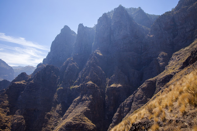
The surroundings of the Roque offer beautiful views around Caldera de Tejeda. As I said, the walk could be extremely short, if you simply drive up to the car park, but doesn’t need to be, if you feel energetic. It can be done as a side branch of one of many possible circular routes that start and end in Tejeda.

For example, this circular route — https://es.wikiloc.com/rutas-senderismo/circular-tejeda-por-timagada-y-las-moradas-191897592 — is just over 8 km. The visit to Roque Bentayga will add another 6 kilometers to it. And if you don’t feel as energetic as those resulting 14 kilometers you can do what I did — take a bus to shave off some of the distance, visit Bentayga and return to Tejeda walking. The number of routes criss-crossing the center of the island is such that it permits endless permutations. 

Friday, December 20, 2024

Chimirique — Around Roque Nublo — Tejeda

From the foot of Roque Nublo towards Altavista

This time round, I and a few other people were let down by the local public transport system. Normally, it is reasonably reliable. Buses are occasionally late, of course, but so far I don’t remember the delays forcing me to change my plans. Well, there is always a first.

This time, the very infrequent bus number 18 which links Tejeda with Maspalomas was almost one hour late, so I had to change the plan. The route I did links Chimirique, a steep rock formation close to Juncal de Tejeda, to Roque Nublo, then going down to Tejeda. It is a classic ascent to Nublo, and forms a part of many possible routes around the centre of the island. 

Monday, December 09, 2024

Sardina del Norte — Puerto de Las Nieves

Cave house at the end of the promenade, Sardina del Norte

I did this easy hike several times already, sometimes alone, sometimes in a small group. It is not very long, less than 11 kilometres, and doesn’t have that much ascent and descent, below 500 metres of both. Both villages are reasonably well connected by public transport, so you can do the hike in either direction. Just keep in mind that Sardina has a nice sandy beach, but fewer places to eat versus the pebble beach, rocky natural pools and disproportionate number of restaurants per square head of population of Puerto de Las Nieves. 

Wednesday, November 27, 2024

The Guardian of Bentayga, The Dog of Bentayga, etc.

Here is is. Who’s a good boy? Sit! Good boy!

Last year, when we were on our way back, and rather steeply up, from Cuevas Del Rey, a young couple graciously gave us a little lift, thus saving a bit of walking up on a wide zigzag. They themselves were looking for a rather curious rock formation, which they called El Guardián del Bentayga, The Guardian of Bentayga. Roque Bentayga is a prominent volcanic formation in the middle the Caldera de Tejeda, and the dog-shaped rock in the photo was looking at it, with Tejeda village in the background. 

Sunday, December 05, 2021

Altavista, or Azaenegue

View west from the viewpoint, La Aldea de San Nicolás to the left

A walk along the crest of Altavista, or Azaenegue in aboriginal language, towards a viewpoint on the end closer to La Aldea is one of the easy and beautiful linear walks in the vicinity of Artenara village, on the edge of Tamadaba nature park. It does have some ascents, with the corresponding descents, but they are as light as they go on the island. There is no getting lost either. The only problem here is the transport to the start of the walk, the same as in nearly all of the walks to the west of Artenara. Once again, driving, or being driven, is the most realistic option for a one-day trip. But, unlike Faneque, you can do it if you stay in Artenara village; you can even do the longer version of the walk starting in Artenara and using the public transport, but you will have yourself a very tiresome day.

Faneque behind the solitary pine. The pine was burnt partially in the Valleseco wildfire in 2019

Tuesday, June 08, 2021

El Camino del Cartero, The Postman’s path, Gran Canaria

La Aldea de San Nicolás to the left. To the right, a new road.

La Aldea de San Nicolás, or simply La Aldea, is the least accessible village of all on Gran Canaria. There are three roads leading to it — one from Mogan, another from Agaete, and another from the central part of the island, Artenara and Tejeda. All three of these roads are quite long on the island’s scale, narrow, curvy and difficult, and at least two of them close whenever it rains. Emergency services occasionally have to go to La Aldea by helicopter, which of course has its own limitations.

Sunday, November 15, 2020

Barranco Hondo, the Deep Ravine, and Salinas de Tenefe

Impressive cliffs

The second walk we’ve done in a very short stretch of time — we are all worried that our long awaited freedom will be suddenly taken from us again — is another one that was new for me. The south of the island is full of deep and steep ravines, and one of them has a double arch, called Arco del Coronadero. Of course, we had to go, because, as the famous saying goes, “it’s there”.

Euphorbias large enough for all the King’s horses and all the King’s men to get lost in

Sunday, October 04, 2020

Ventana del Bentayga stone arch, interspecies kiss

Do you see a camel on the left and an elephant on the right?

The amusingly-shaped stone arch above is called Ventana del Bentayga, Window of Bentayga. If you are on the right level, Roque Bentayga formation can be seen through it. If you are slightly above the arch, as in one of the photos below, behind and above Bentayga and to its right small white houses of Artenara village are visible, and directly above it — the top of Tamadaba massif. On a good day, Teide is seen on the horizon, too. The height of the opening is about 4.5—5 metres.

Aserrador massif. Road GC-60 circling it, branch to Juncal goes to the left

Monday, December 23, 2019

Cruz de Tejeda — Pico de Las Nieves

Million euro view

Pico de Las Nieves is the highest point of Gran Canaria, some 1,949 metres above sea level.
Except it's not really the highest point, because its neighbor rocky outcrop with a hole in it, Morro de la Agujereada, i.e. Holey Mountain, is a few meters taller. But you can't get on the top of Agujereada safely and easily, so Pico de Las Nieves is sold as The Summit.*  It's where you get the classic, the most postcardy view, with Roque Nublo, Roque Bentayga and Teide on Tenerife all in front of you.
I have been to it a few times, even watched the sun setting from there, but somehow failed to write it up.

Wednesday, September 25, 2019

Barranco de los Cernícalos — water!

A small waterfall a bit off the path

Finally, I’ve seen all three places where water always runs on Gran Canaria. Well, actually, there are just two left, poor Barranco de La Mina having been killed off by the owner of the water*. So, now on Gran Canaria you have just two places where freshwater runs all year round — Barranco de Azuaje and Barranco de los Cernícalos, Kestrels’ ravine.

Thursday, October 11, 2018

Lomo de San Pedro - Cuevas de Berbique - Puerto de Las Nieves


Impressive cliffs of Tamadaba.
After I went to see Cenobio de Valeron I've shown pics of it to my walking companions. One of them said that it looked similar to Cuevas de Berbique, a toponym which I had never heard before. Of course I had to find out where it was (close to Agaete) and how to get there. To my pleasure I discovered that it is possible to do a linear walk past the caves using the public transport. You have to start from San Pedro (there is more than one San Pedro, so careful, San Pedro of Agaete). Currently, there is a bus from Galdar to "Valle" (which is valley of Agaete). The end of the walk is in Puerto de las Nieves, and there are buses to Las Palmas every hour.

Friday, January 20, 2017

Brussels and around

Grand Place, Brussels

What, exactly, is Belgium famous for, apart from unelected bureaucrats and Brussels sprouts (which are not featured that much in Belgian cuisine)? OK, beer. Fine, chocolate. French fries. Mussels. More beer. But, apart from the bureaucrats, sprouts, beer, chocs, fries and mussels, what have the Belgians ever gave us? Here's my short list.

Tuesday, January 26, 2016

Vamos a la playa, Oh — ohoh ohoh! Playa de Cofete, Oh — ohoh ohoh!

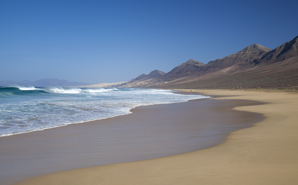
Cofete! Finally :)

This weekend, 23—24 January, we came to Fuerteventura yet again. We used an excellent Bintazo offer by Binter Canarias *. And we came with a very specific aim in mind — to get to Cofete, a difficult-to-access beach on the windward side of the island. I saw it a couple of times before, but never visited the beach. Kirill never even saw it from the ground level.
Getting there takes some research. The road is quite bad, as you will see later. Soon after you pass the port of Morro Jable, the surfaced road changes to a dirt track, very winding and bumpy. Normal cars can go on it, and will reach the beach eventually, but you are not supposed to drive rental cars on dirt tracks. No one will stop you, but if anything goes wrong, you will pay through the nose. You can walk, but that will be heavy going. I estimate the distance between the car park (where the dirt track starts) and the beach to be about 8 km. Plus you have to go by Cofete pass, which is at about 300 meters above the sea level, so each way will feature 300 meters of both up and down. And there is no shade. Biking is possible, but also strenuous and quite dangerous.
Now that you are sufficiently scared, let me give you a solution to this conundrum.

Thursday, August 13, 2015

Cruz de Tejeda — Artenara, summer version

Up and away

I am sure I said it a few times already, but let me say it once again — Caldera de Tejeda on Gran Canaria is the most spectacular place I’ve ever been. Whatever the weather (and it is usually much better there than in Las Palmas anyway) it never fails to deliver. Some sort of magic at work for sure.

I already did this trail, back in March, but I did it in the opposite direction, starting from Artenara. This time I embarked on the walk from Cruz de Tejeda.

Monday, August 03, 2015

Cruz de Tejeda — Teror, summer version

Barranco de las Nieves, or maybe de las Laguentas, or maybe de la Mina. Go figure

My legs!!! Three days later, they're still hurting. That's the first and the last thing that comes to my mind when I think about this hike. But surely there has to be something else to remember, right?
Back in February, Tamara did this walk (and got lost) on her own. This time, I was helping. We still got lost, but in a slightly (?) different place. I know, I know, let me start from the beginning.

Tuesday, March 17, 2015

Cruz de Tejeda - La Culata - Roque Nublo - La Culata walk

Little uneven-shaped Nublo asteroid, just for the heck of it :)

Roque Nublo is the most iconic sight of Gran Canaria (and don't tell me about the dunes, they are not a patch on the dunes on Fuerteventura). Since my favourite spot on the island is Cruz de Tejeda, I saw and photographed the Roque many a time, but I'd never been right next to the monolith until yesterday.