 |
| These pines kept their needles, although they are dry and yellow. I think they have a good chance of recovery. |
I was hoping to never write this kind of report again, but it was not to be.
Only two years after the fire which started inside Caldera de Tejeda and burned the Parador de Tejeda hotel, and despite the controlled burns in the central areas of Gran Canaria, another fire ran through the tops of the island, Las Cumbres. Several fires, to be precise, one of them, tagged in social media with #IFValleseco, especially big.
 |
| This slope shows the unknowable way of fire. Some of the young canarian pines are burned to a “naked branches” stage, some kept their needles, and there are some that even kept green tops, in the upper left and lower right corners |
It started, as the hashtag suggests, in Valleseco, one of the most difficult to access populated areas of Gran Canaria. The cause, when I read it last, was believed to be an electrical failure. It spread exceptionally quickly, going up along several ravines and passing into Caldera de Tejeda. Once over the lip of the caldera, it sped up and spread and started to re-burn areas already affected by the previous fire, #IFArtenara. One of the points of entry was Madrelagua, a long ravine that eventually becomes Barranco de Azuaje.
 |
| View down the ravine Madrelagua, the most thoroughly burnt area I saw. |
Because another fire was just put out one day ago, the reaction was fast — firefighters were sent in from all the islands and from the mainland, along with helicopters and watertankers from Group 43 of the military support unit. The latter were the most spectacular addition to the firefighting efforts. For the lack of freshwater bodies large enough to catch water, they had to load up with salt water. They did it in the aquatic territory of the port of Las Palmas, giving the locals and tourists something to look at.
 |
| About to touch water. Looks like an aerial attack, doesn’t it? They arrived to fight the previous fire, #IFArtenara, don’t know if they even had time to depart in between. |
 |
| Amazing spectacle. No wonder that there were crowds of people standing on the Avenida Maritima, greeting the planes. |
 |
| Taken from our balcony. No, it didn’t crash, but those guys were doing some amazing things in the air, flying low, between houses, taking water very close to the boats, etc. |
In total, I believe they said about 9000 people were evacuated from Las Cumbres. Once the fire entered the natural park Tamadaba, a Canarian pine forest full of floral endemics and dry pine needles it was said to be unstoppable. That is, it couldn’t have been stopped by human efforts, if it had wished to burn, it would have burned. Fortunately, it did stop, and we were even told the Tamadaba wasn’t affected as badly as it was feared (of which later).
 |
| Image taken from La Puntilla, one of the edges of Las Canteras beach in Las Palmas. You can see the top of the island outlined in flames. |
So. When the roads were opened and I though it was safe to go*, I went to check out how the path of the fire looks.
It looks much, much worse than two years ago. The forest floor is turned to ashes. There is no undergrowth left. Canarian pines, fire-resistant though they are, burnt to a “naked branches” stage in many places.
 |
| Various degrees of fire damage, including some untouched trees on the slopes of Montañon Negro. |
Going along the simple route Cruz de Tejeda — Artenara was a sad and hot affair. When the ground is essentially black and the sun is out, you feel like you are slowly roasting in the oven with both the top and bottom heaters on.
I’ve been there twice since the end of the fire**, the second time with Timur. There was about a week between the two visits, with almost no improvements visible in between. One dubious improvement was the appearance of bracken shoots. Bracken being an invasive species, that is no improvement at all.
 |
| Anther sign of life was the appearance of new leaves on a burnt sweet chestnut tree. Same as two years ago, fire seems to have confused the chestnuts — the buds, which should have stayed dormant till spring, awakened. But at least it shows that the tree is alive, a good sign. |
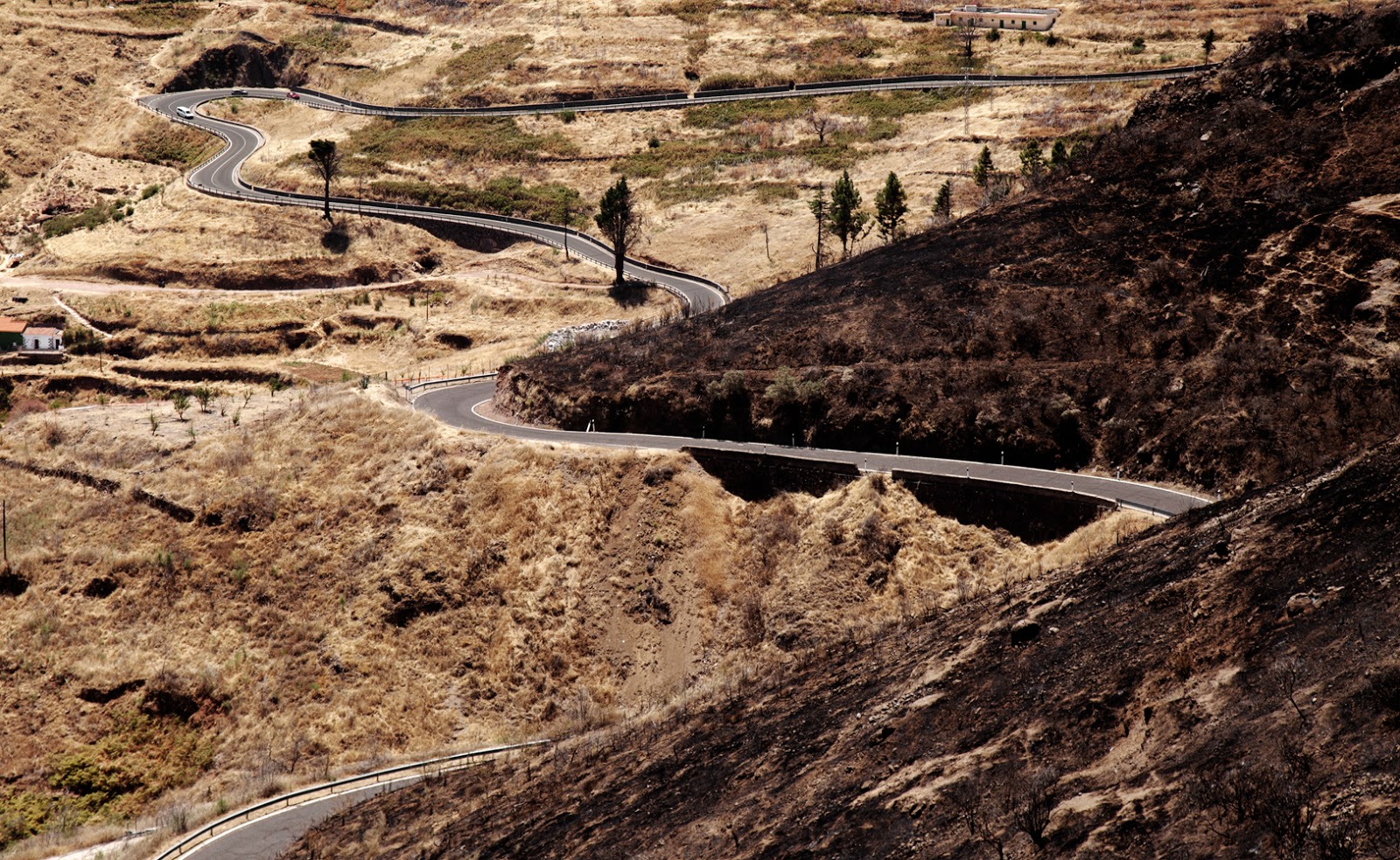
The dry straw is one of the main conductors of the fire. In many places you could see that a relatively small gap in vegetation, such as a road, worked as a firebreak.
 |
| Where the fire stopped |
Just a few more pics to show what we saw on our sad walk.
 |
| I always thought that the rock formation on the left resembles a Devil’s head. Now I think he looks smug and pleased looking into the burnt caldera |
 |
| One of the burnt path markers. The pole is gone, it fell off. We left it were it was.I think it would be a nice thought-provoking addition to one of the local museums. |
 |
| One of my favourite landscapes on the island. Still beautiful of course |
 |
| That’s how the Tamadaba massif looks from the path. As you can see, most of it is yellow, some (to the left), burnt to black, and some green tops still remain. The undergrowth probably all gone. Don’t know if it is really “better than we feared”. |
So, to resume a little:
60% of the surface of Artenara municipality were affected by the fire. There was no loss of life this time, something to be grateful for.
All the plants of silver tansy are gone together with the rest of underbush. The plant is perennial, there is a chance that some roots survived, but it is too early to to tell.
Once the autumn comes, there will be more reforestation events and I do hope they will be less about entertainment and more about some real forest management.
The route is the same as in here, you can also see and compare some pics of before and after.
Pics of aftermath of forest fire — here.
--------------------
* According to some, it wasn’t. That is, I mustn’t have gone. But I have and I can’t now ungo.
** As I write, the fire is under control and essentially extinguished, but Tamadaba still closed to the public.


No comments:
Post a Comment