Showing posts with label inland. Show all posts

Thursday, June 09, 2022

La Palma, Volcano Route, Ruta de Los Volcanes

Absolutely spectacular and very, very black ashes on Cráter del Duraznero, formed in 1949

The Volcano Route, Ruta de los Volcanes, on beautiful La Palma, is one of the most famous hiking routes of the Canary Islands, the other equally famous one being the ascent of Teide. The latter can be done in various ways (1, 2) though, whereas the Volcano Route is singular, running along the crest of the island north to south. The path forks a little sometimes, but the signs always and unambiguously point to the main path.

I was planning to do it for a while, and decided to go now-now, while the weather is not too hot. Let it be said right away that it is very beautiful, very worth going, but needs reasonable physical form and some preparation.

Spectacular Caldera de Taburiente, the morning clouds are still floating inside

Friday, October 23, 2015

Barranco de la Mina, Gran Canaria

For Tamara’s birthday, we went for a short walk from (more or less) Las Lagunetas to Cruz de Tejeda. We often heard that Barranco de la Mina is one of very few — maybe just three? — barrancos where there always is running water. The previous attempt to reach it had to be cancelled thanks to roadworks. The advantage of this route is that it’s almost pure ascent. So my knees did not complain this time.

Elephant tree

Friday, October 09, 2015

Pico de la Bandera — San Pedro

View into the Valle de Agaete from the trail. There is a whole chain of reservoirs down there, some at alarmingly different levels from each other

This was our first but hopefully not last experience with Mojo Picón Aventura, a small company dedicated to outdoor activities on our beautiful island. Apart from their regular weekday activities such as canyoning (barranquismo), coasteering and kayaking, they also organise walks on weekends. So the last Saturday of September we joined one. It was advertised as a medium-difficulty 9-km route "Pico de la Bandera — Berrazales" which was supposed to take about 6 hours. The price was 10 euro per person; considering that we would spend the same or more on public transport if we wanted to do the same route on our own, it looked like a great value for money.

We had to come by 8:30 am to Auditorio Alfredo Kraus, which appears to be a popular meeting place for weekend outings. There were at least two other groups assembling there at the same time.

Sunday, July 26, 2015

Circular walk from Caldera de Los Marteles to Mirador Pico de las Nieves and back

The main purpose of the walk was to see this

We went for an evening walk to Pico de las Nieves organised by Couchsurfing Gran Canaria. The plan was to start at Caldera de los Marteles, go up to Pico de las Nieves to enjoy the sunset and have some food/drink, and then go back to Caldera de los Marteles by different path. This is the first Couchsurfing event of this kind we've ever attended and it turned out to be great.

Wednesday, May 27, 2015

Gran Canaria, Barranco de Azuaje

A couple of weeks ago we went for a weekend break in Firgas, a small village inland from the north shore of Gran Canaria.

We were staying in a flat very close the center of the village (which is not hard considering the size of it).

It is a nice place, but be warned — precisely because it is close to the village center, Friday and Saturday nights are likely to be noisy, as people trample along the street outside your front windows to get to the bars and restaurants and then back again, talking as they tend to do (well they are Spanish, so they gotta). If it is just one or two of you, or even a family with one small kid you won’t have a problem though — the bedroom is towards the back of the flat. I had to use the sofa bed in the front room of the house, that’s why I could hear the street.

Monday, May 18, 2015

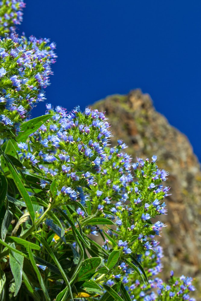
Tajinaste azul de Gran Canaria o de Tenteniguada, blue candles of Gran Canaria

This post is mostly a reminder to myself to repeat (and improve on) the experience next year. Read on if you are interested in flowers though.

Some while back, when the spring was only just starting, I noticed that some of the companies that advertize for guided tours were offering "Ruta de Tajinaste azul" (Route of Blue *Something*, where "something" was a word I'd never seen before.)

A little while later, I went for a walk around Teror and noticed some tall blue flowers on the slopes - not many, and a little bit too far off the path to go and investigate. I got interested and then connected those two things together - people going to look at something blue, and these tall blue flowers, very visible amongst the vegetation that tends to yellow.

Monday, January 19, 2015

Cruz de Tejeda to Tejeda village

I want to describe a short, nice (and unexpected) walk that I took a few days ago.

It might be useful for somebody who, like me, usually relies on maps to find their way around.

This walk, although it has an official number (S-85), is not specified on my Kompass map. It could be because there are so many walks in the area, but still it’s a shame this one is missing. It is one of those walks that combines simplicity, shortness, spectacular views and even the public transport at both start and finish. Believe me, it is rare.

Thursday, April 11, 2013

Montaña de la Arena

We didn’t have much luck with the sun during this excursion. One of a few small pools of light on the landscape

Montaña de la Arena is a small dark mountain between Lajares and Villaverde/La Oliva. I passed it many times when doing a part of trans-Fuerteventura path GR 131. Once we tried to go up it with friends, but turned back when we discovered that the side of the mountain that we choose was one large scree. That was the side which looks at Lajares, northern face more of less.

When I saw the announcement of the excursion to the Montaña de la Arena on Facebook, I joined. I figured that maybe there is a good path up that I failed to spot myself.

Well, I was wrong. Where we went, there is no good path. There are bits when it looks sort of like one; but those are separated by stretches of pure picon, black volcanic gravel. You step up and slide down by the same amount, and you step up again, and you guessed the rest. It’s not an easy climb, and I don’t recommend to go where we went — southern face.

Sunday, January 20, 2013

Montaña de Ecanfraga, take two

On Friday I had another go at Ecanfraga. This time I thought, “ok, I couldn’t go around it before, but I did go half way up. Now, I will try to go up”.

I almost succeeded, but only almost. My map doesn’t show the way up, so I have to choose how to go myself. The caldera of Ecanfraga has the usual horseshoe shape, maybe a little more angular than the others. I choose to go up by the side of the horseshoe that is closer to Villaverde. I came close, but the path disappeared completely about 30 meters from the top (that’s my estimate, and I am not very good at judging distances up). It was still possible to carry on up, the stones are solid and not slippery, but I was alone and chickened out somewhat.

Monday, June 11, 2012

Calderon Hondo


On Saturday I went on excursion to Calderon Hondo next to Lajares with a small group of people none of whom I've seen before. Once again Facebook proves to be useful tool for a surprising variety of things.
The walk was easy and went along well paved paths. It is a section of a much longer walk that joins the two ends of the island together (Corralejo-Morro Jable). I knew about its existence; but for a potential tourist attraction it is quite surprisingly badly advertised. Up till very recently I believed that the walk runs through the dunes, and only stumbling upon the signpost at the foot of Bayuyo made me realise that it is not the case. The first leg of the path is Corralejo - Lajares; and the Calderon Hondo is just off the path. I am not sure why it is called "Calderon", and not "Caldera"; the difference that I can see between, say, caldera of Isla de Lobos and this one is that Calderon Hondo kept all the walls of the volcanic cone, and caldera of Lobos lost a section facing the sea. Here you can see just a part of the opening; one of my companions took a great picture of the whole; but I can't figure how to place a link to a photo in facebook, they've seem to have changed something again.