Saturday, September 19, 2015

Camping in Llanos de la Pez

Afternoon light is a lot more interesting than the morning one

Our little tent was bought and used only once some six years ago, on occasion of the Wells-next-the-Sea Carnival. Since then, it was gathering dust; we thought it was about a time to take it for a spin.

Sunday, August 30, 2015

La Gomera, Degollada de Peraza — San Sebastián

We spent almost all summer in Gran Canaria. Which was nice, but, for a bit of change, we went to La Gomera for five days. We took the early flight on Sunday morning, and were relaxing for the rest of the day.

La Iglesia de la Asunción, San Sebastián de La Gomera

On Monday, we did essentially the same walk as Tamara and kids did in April. For Tuesday, we had more ambitious plan: to walk from Degollada de Peraza all way down to San Sebastián.

Thursday, August 13, 2015

Cruz de Tejeda — Artenara, summer version

Up and away

I am sure I said it a few times already, but let me say it once again — Caldera de Tejeda on Gran Canaria is the most spectacular place I’ve ever been. Whatever the weather (and it is usually much better there than in Las Palmas anyway) it never fails to deliver. Some sort of magic at work for sure.

I already did this trail, back in March, but I did it in the opposite direction, starting from Artenara. This time I embarked on the walk from Cruz de Tejeda.

Monday, August 03, 2015

Cruz de Tejeda — Teror, summer version

Barranco de las Nieves, or maybe de las Laguentas, or maybe de la Mina. Go figure

My legs!!! Three days later, they're still hurting. That's the first and the last thing that comes to my mind when I think about this hike. But surely there has to be something else to remember, right?
Back in February, Tamara did this walk (and got lost) on her own. This time, I was helping. We still got lost, but in a slightly (?) different place. I know, I know, let me start from the beginning.

Sunday, July 26, 2015

Circular walk from Caldera de Los Marteles to Mirador Pico de las Nieves and back

The main purpose of the walk was to see this

We went for an evening walk to Pico de las Nieves organised by Couchsurfing Gran Canaria. The plan was to start at Caldera de los Marteles, go up to Pico de las Nieves to enjoy the sunset and have some food/drink, and then go back to Caldera de los Marteles by different path. This is the first Couchsurfing event of this kind we've ever attended and it turned out to be great.

Wednesday, May 27, 2015

Gran Canaria, Barranco de Azuaje

A couple of weeks ago we went for a weekend break in Firgas, a small village inland from the north shore of Gran Canaria.

We were staying in a flat very close the center of the village (which is not hard considering the size of it).

It is a nice place, but be warned — precisely because it is close to the village center, Friday and Saturday nights are likely to be noisy, as people trample along the street outside your front windows to get to the bars and restaurants and then back again, talking as they tend to do (well they are Spanish, so they gotta). If it is just one or two of you, or even a family with one small kid you won’t have a problem though — the bedroom is towards the back of the flat. I had to use the sofa bed in the front room of the house, that’s why I could hear the street.

Monday, May 18, 2015

Tajinaste azul de Gran Canaria o de Tenteniguada, blue candles of Gran Canaria

This post is mostly a reminder to myself to repeat (and improve on) the experience next year. Read on if you are interested in flowers though.

Some while back, when the spring was only just starting, I noticed that some of the companies that advertize for guided tours were offering "Ruta de Tajinaste azul" (Route of Blue *Something*, where "something" was a word I'd never seen before.)

A little while later, I went for a walk around Teror and noticed some tall blue flowers on the slopes - not many, and a little bit too far off the path to go and investigate. I got interested and then connected those two things together - people going to look at something blue, and these tall blue flowers, very visible amongst the vegetation that tends to yellow.

Sunday, April 12, 2015

La Gomera, Degollada de Peraza - Los Roques


We went to La Gomera for four days during this Easter Break (Semana Santa). (Now we've visited all the big Canary Islands except El Hierro).

Admittedly, four day are not enough to explore even La Gomera properly, but we had a  good go at it. Our kids are still not that keen on walking, so I had to plan only some very short and not too up-and-downy routes. Even so, a couple of times I had to leave them somewhere in the shade to wait for me and went ahead on my own.


Tuesday, March 17, 2015

Cruz de Tejeda — La Culata — Roque Nublo — La Culata walk

Little uneven-shaped Nublo asteroid, just for the heck of it :)

Roque Nublo is the most iconic sight of Gran Canaria (and don't tell me about the dunes, they are not a patch on the dunes on Fuerteventura). Since my favourite spot on the island is Cruz de Tejeda, I saw and photographed the Roque many a time, but I'd never been right next to the monolith until yesterday.

Monday, March 09, 2015

Artenara — Cruz de Tejeda walk

Artenara is one of the not-so-easily accessible villages on Gran Canaria. It is overlooking the Caldera de Tejeda, and is on a slightly higher level than Tejeda. There are even fewer buses, the one I caught was from Teror and I believe it is the only route — bus number 220.

We’d been through Artenara once before but it was literally that — going through with just a small pause at one of the miradores (I swear the village has more viewpoints per capita than anyplace else I’ve been before). My plan was to get there, to walk about the village, maybe have a lunch and head back.

Tuesday, March 03, 2015

Las Palmas carnival 2015


I was looking forward to my first carnival at Las Palmas and was not disappointed. While perhaps not as spectacular as the carnival of Santa Cruz de Tenerife, the Las Palmas Carnival nicely combined both the show and street party, with audience participation levels very high. It is also very accessible - if you want to, you can see all the events for free, get a good view of all the participants - including the carnival queen and dames, or even ride on one of the floats in the main parade - there are places for hire, I didn't realize it before.

Wednesday, February 25, 2015

Cruz de Tejeda — Teror walk

So far Cruz de Tejeda is my favourite place to go on Gran Canaria. Somehow, even when the weather is terrible elsewhere, it changes by some miracle once I am on the pass, and there are views to die for in all directions. Only once did I catch the pass itself in clouds, but they were shifting and parting all the time, allowing the views down into the caldera, all the way to Teide on Tenerife and to the Gran Roques — Nublo and Bentayga.

Tuesday, February 03, 2015

Tejeda, Las Fiestas del Almendro en Flor – Almond Blossom Celebration

This Sunday me and the kids went to the Celebration of almond bloom in Tejeda. In the morning I was very much in two minds about going — the day started really gloomy in Las Palmas, with short but intense showers of rain. We procrastinated for a goodish while, but then figured that we could go to San Mateo, and re-think again there.

When we arrived to San Mateo the drizzle was constant and it was “freezing” by Canarian standards — one of the chemist shops was showing +11 on their clock, plus the roads to San Mateo were very busy because of the Sunday market so it took a long time to get there. Everything was looking grey and flat, with only outlines visible. I was all for going right back, but the kids, to my surprise, wanted to carry on — and I am very glad we did.

Monday, January 19, 2015

Cruz de Tejeda to Tejeda village

I want to describe a short, nice (and unexpected) walk that I took a few days ago.

It might be useful for somebody who, like me, usually relies on maps to find their way around.

This walk, although it has an official number (S-85), is not specified on my Kompass map. It could be because there are so many walks in the area, but still it’s a shame this one is missing. It is one of those walks that combines simplicity, shortness, spectacular views and even the public transport at both start and finish. Believe me, it is rare.

Sunday, January 04, 2015

Caldera de Bandama in winter

Gran Canaria received its share of long rains in the end of autumn - not as much as Tenerife, but sufficient for the local flora to wake up. It is not the time of most flowers yet, but the mountains look green and you can see the occasional splash of color here and there. Some of the early bulbs managed to finish flowering and wilt "when I wasn't looking", as I discovered in a local botanic garden. So now I am trying to go and check out what happens with the plants as often as I can.


Sunday, September 28, 2014

La Palma: Mirador El Time to Puerto de Tazacorte

During our short visit to La Palma, we didn't do much walking - partly because it really was short, partly because our kids are still not that keen on walking any distances at all, especially where going up is involved. And there is an awful lot of ups on La Palma - balanced by the eventual downs, but still. So, when we found ourselves on the top of the extremely steep cliff called El Time, and I saw a pointer to Puerto de Tazacorte, saying "3.2 km", I thought "yeaaah! finally, let's go, it's down and it's really close!".

Sunday, August 24, 2014

Pico de Bandama and Caldera de Bandama


OK, time to resume some walk descriptions after a long break.

We haven't done a lot of walking here on Gran Canaria yet - partially because we arrived in summer, and the heat stayed considerable. Partially is due to the way the land lays here - the island is a lot steeper and more developed than Fuerteventura, so you can't easily see where exactly you are going and you are much more likely to encounter some sort of obstacle on your path. Those could range from a barbed wire fence and overzealous guard dogs, to quite unexpected (and, perversely, unfenced) drops.

Thursday, February 13, 2014

Flamenco photoshoots with Anna Villacampa Gómez

At last, after almost a year of thinking about it, I am writing about two flamenco-themed photosessions that we had on Fuerteventura with Anna Villacampa Gómez, a beautiful lady and a great dancer. As usual, we procrastinated for an awfully long time before arranging the shoot — and the arrangement was finally made only because of our imminent departure.

One of the photoshoots was in the dunes of Corralejo, and the other in the malpais on the road to Tetir, by dead fig tree shaped by the prevailing winds. The second location was suggested by Anna, while we’ve been planning to do the dunes for two years. A piece of red gauze was bought to fly in the wind, Anna choose her own favourite dresses and off we went.

She proved to be a great model. Despite the heat on both days, she was happy to pose and move and dance. The minimalistic background of the dunes worked like a charm, and the dead tree, although making pictures a lot busier, always provided some parallels to the graceful movements of the dance. I enjoyed both days immensely, and so I hope did Anna.

Pictures in no particular order. Enjoy :)

Thursday, June 27, 2013

Barranco de las Penitas

In line with our moving plans, there are almost no place left on Fuerteventura where I really wanted to go and didn’t get yet.*

Last week we went for a walk in Barranco de las Penitas — one of the greenest places on the whole island. It’s a sort of continuation of the valley where the old capital of Fuerteventura, Betancuria, sits. The barranco (ravine) runs towards the west coast of the island, joining eventually with El Barranco de la Madre del Agua, to form even bigger Barranco del Ajuy, which flows into the ocean by (you’ve guessed it) Ajuy.

Thursday, June 13, 2013

Morro Jable — Gran Valle — Cofete Pass — Villa Winter

A view towards Villa Winter from Degollada de Cofete (Cofete Pass)

Cofete is one of the places on Fuerteventura where I always wanted to go and somehow didn’t manage to do so. Even now I can only put a half-tick in that particular box (which is a bit nonsensical, same as the one-palmed clap). But I came close this time.

I have now so many people and organizations from Fuerteventura listed as contacts in Facebook that it brings me all sorts of useful info. On the page on Cabildo (sort of like the island’s council) I saw an announcement of the excursion to Cofete organized within a program called “Fuerteventura al Golpito”. They arrange excursions more or less every two weeks, provide a guide (or two, as it was in our case), and a free bus which picks people at Puerto del Rosario and Gran Tarajal. You have to phone and put your name on the list, and then they send you a message a couple of days in advance, stating the meeting place and time, plus in this case a change of route.

The original route was estimated to be two hours longer than the one that we eventually did, and I am jolly glad of the change too. It was hard going as it was, we were back in Morro Jable in six hours instead of the estimated four, and we didn’t stop for very long anywhere. Even the stop at Villa Winter was rather brief.

The Villa Winter itself was rather disappointing, I must say. I don’t know what I expected really, but the place has this aura of mystery about it (hidden rooms! secret passages! a submarine can come up right to the basement! etc.) so I didn’t expect goats, rubbish in the inner courtyard and peeling walls. Maybe, if the owners allowed us into the basement, as they sometimes do apparently, I would be more impressed, but they didn’t, so I wasn’t.

The route was beautiful if somewhat hard. Shame that we didn’t have time to come down to the water level, but that would probably have delayed us a lot more, and the bus driver was apparently getting really impatient as he was counting on the shorter time.

Saturday, April 20, 2013

El Barranco de los Enamorados — or so I think at least :)

Face of the barranco. Chess Pieces. Moai of Fuerteventura. Take your pick

I wanted to find this particular ravine, El Barranco de Los Enamorados (or de los Encantados), ever since I saw some amazing pictures of it in Facebook. It proved to be not that easy — my excellent KOMPASS map doesn’t have this name, and all the local maps I saw so far don’t have even the most basic stuff, let alone barrancos. I wanted to join one of the excursions that are organized by local walking groups — that didn’t happen somehow. I asked for the directions and got contradictory answers (it’s close to Lajares — no, actually, to La Oliva — no, it’s very close to the Playa de Esquinzo — it’s to the left — no, to the right — actually, just carry on straight...). I asked to point it out on a map; even that was a bit vague. So. I am inclined to think people talk about somewhat different places, but all of those places share one thing — amazing smooth water patterns on the sandstone.

Choosing the directions that pleased me by their simplicity (“just take the unused branch of Lajares roundabout and carry on straight, you can’t miss it”) I went there with a friend. We followed a huge barranco that starts close to Lajares roundabout; when we came to the place where it separated into three branches we started to walk the middle one. We soon met a small group of people, all looking local, and asked them for directions, just to make sure. The main guy took the words out of my mouth — “El Barranco de los Enamorados? No, you took a wrong turn, we are going that way, follow us and then I show you were to go”. (So much for “it’s straight, you can’t miss it”). We followed them to where they parked their 4x4; he told us that “from here it’s probably one more kilometer that way”. Off we went. Problem is, barrancos tend to branch off. That day we took a “wrong” branch — it was nice and had some interesting sandstone structures which were probably petrified plants — but we haven’t found what we were looking for.
So, we went again. This time we found all the stuff you can see on the pictures. I am still not that sure that we found “the” barranco, but I will give the route we followed, and point out at least one alternative I found. I can tell you without false modesty that my pictures are a lot better than what I saw before, but can’t tell if that is because we found a better place or it’s just because I haven’t seen other pictures that do the place justice.

Thursday, April 11, 2013

Montaña de la Arena

We didn’t have much luck with the sun during this excursion. One of a few small pools of light on the landscape

Montaña de la Arena is a small dark mountain between Lajares and Villaverde/La Oliva. I passed it many times when doing a part of trans-Fuerteventura path GR 131. Once we tried to go up it with friends, but turned back when we discovered that the side of the mountain that we choose was one large scree. That was the side which looks at Lajares, northern face more of less.

When I saw the announcement of the excursion to the Montaña de la Arena on Facebook, I joined. I figured that maybe there is a good path up that I failed to spot myself.

Well, I was wrong. Where we went, there is no good path. There are bits when it looks sort of like one; but those are separated by stretches of pure picon, black volcanic gravel. You step up and slide down by the same amount, and you step up again, and you guessed the rest. It’s not an easy climb, and I don’t recommend to go where we went — southern face.

Sunday, March 31, 2013

Pico de Zarza

While Europe is getting an unhealthy share of snow and cold, it’s getting hot and summery here on Fuerteventura. So I figured it’s time to do this walk before it becomes impossible, or at least very, very uncomfortable.

Pico de Zarza is the highest point of Fuerteventura, just over 800 meters high (just now I found a figure of 807, but it seems to me that I saw some other heights somewhere). When the sky is clear you can see all of Fuerteventura, Gran Canaria and Teide on Tenerife from there. The sky wasn’t that clear when we went, so we didn’t see the other islands. Still, the views are spectacular and the walk well worth doing.

Above is the view along the wild Cofete beach (btw, the only remaining point of the island that I really want to visit and haven’t visited yet).

Wednesday, March 06, 2013

From La Pared to Sotavento de Jandia

The urge to climb and then jump off the sharp rock is irresistible to some

Last Saturday we went for a long walk with my former Spanish class. The walk started around La Pared village on the west coast of Fuerteventura, ran along the shore for the goodish while, and then started to traverse the island. It ended up at main road FV-1, at the level of southern end of Playa de Sotavento de Jandia.

I liked the walk a lot, the coastal path is absolutely spectacular, but there are a few somewhat difficult points about it that I’d like to record.

First, logistically it’s not easy to organize on your own. It’s not circular, and if you want to go by car, you will have to go through a palaver of arranging at least one at the end of the walk, then ferrying people between the end and the start. We had it easy, as the center provided the bus that brought us to the start and picked us up at the end. I am not sure if the walk is doable by just public transport, but inclined to think that it isn’t.

Second point — most of the route runs along the sandstone ledge not much above the high water level, and under a tall wall of sandstone. There is no or very little mobile reception; so not a great idea to try the walk on your own even if you managed to somehow arrange the transport. Apart from our large group, we met very few people along the path.

Third point, linked to the previous — sandstone ledge runs out occasionally, or becomes quite steep. Nothing too bad, but — watch out and have somebody else watching out for you.

Apart from that, nothing much I can add. Enjoy the views :)

Monday, March 04, 2013

Gardens, gardens everywhere

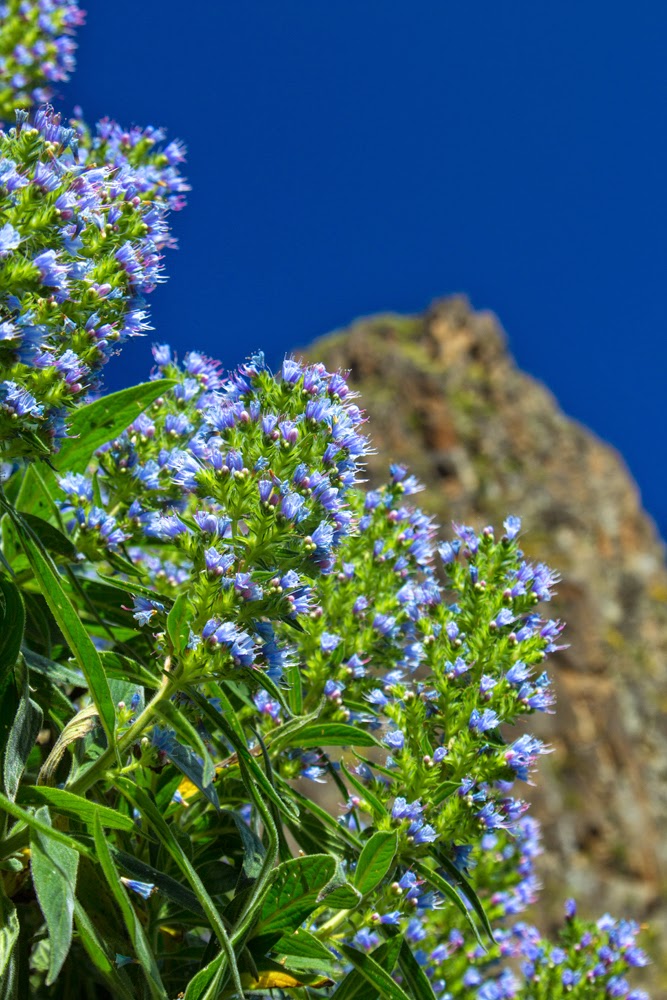
Anybody who knows anything at all about me knows that I like flowers. And in Puerto de La Cruz there are at least two big gardens. So I went to both this time :)

One is "Jardín Sitio Litre", which is confusingly marked as "Orchid garden" in the little tourist map, private property attached to a largish house where the current owners live. The current name is the result of somewhat japanese-sounding transformation of the original "el Sitio Little", "Little's Place", after Archibald Little, the first owner of the estate. It's not big, well established, nicely laid out, with some space dedicated, yes, to orchids, a koi carp pond, fountain, small cafe etc.

Another one is the "real" botanical garden, know as Jardín de Aclimatación de la Orotava, Jardín Botánico or El Botánico. It's larger, but still nowhere as large as Cambridge botanical garden for instance, let alone Kew. Acclimatization bit in the name is there because it was used to acclimatize plants brought from different parts of the world.

Well. I liked the second one more. It's bigger, collection is more impressive, the entrance is just 2 euro for Canarian resident (dat's me) against 4.75 for the Orchid Garden. Plus, to be honest, I was lured to the Orchid garden by the name, hoping to see a lot of beautiful, well, orchids. I don't know if it is the season or what, but you will see more orchids in Scotsdales garden center. Maybe the garden holds more variety - I don't remember seeing Lady slipper orchids in Scotsdales, for instance. Maybe. Still, I was somewhat disappointed

Now, I wrote this sorry excuse for a text just to be able to post some flower pictures. So here they are :)

Tuesday, February 19, 2013

Santa Cruz de Tenerife Carnival Parade 2013


I've heard many times that the carnival in Santa Cruz de Tenerife is something worth watching. "Second biggest in the world", "immediately after one ends, everybody starts preparing for the next one", "amount of feathers and sequins like you won't believe", etc, etc...
Last year we were quite content with much more humble offering of Corralejo and Puerto del Rosario, but this year I figured I should go have a look at Tenerife.
Now, I am not an expert on carnivals. Carnivals that I saw in the UK are basically few days affairs, sometimes just one-day affair, when you have a procession and that's pretty much it. Here it is not the case - various events leading up to the main parade start a few weeks in advance. But I couldn't of course drop everything and go for a few weeks, so I restricted myself to just four days. That allowed me to see the two biggest parades on the island - one in Santa Cruz on the day of arrival, one in Puerto de la Cruz on the day of departure, with the Burial of the Sardine and drag "put your heels on" parade in Puerto fitted in between.

Sunday, February 03, 2013

Tindaya


I was looking in the direction of Tindaya for quite some time, figuring out how to get there without a car. It’s possible, but tricky, as there are just three buses per day that go past the village. You can start from further, at La Oliva, but that involves walking some nine kilometers to the mountain before going up, and that somehow didn’t seem so very attractive.
Apart from that, there was always a nagging question that nobody could quite answer — do you need a permission to ascend Tindaya, it being a protected area, sacred mountain and all that.
So I was really happy when I got a call from my former Spanish teacher saying that there will be a group excursion for Tindya, that we have enough cars and that he sorted out the group permission with ayuntamiento (district council) *.

Sunday, January 20, 2013

Montaña de Ecanfraga, take two

On Friday I had another go at Ecanfraga. This time I thought, “ok, I couldn’t go around it before, but I did go half way up. Now, I will try to go up”.

I almost succeeded, but only almost. My map doesn’t show the way up, so I have to choose how to go myself. The caldera of Ecanfraga has the usual horseshoe shape, maybe a little more angular than the others. I choose to go up by the side of the horseshoe that is closer to Villaverde. I came close, but the path disappeared completely about 30 meters from the top (that’s my estimate, and I am not very good at judging distances up). It was still possible to carry on up, the stones are solid and not slippery, but I was alone and chickened out somewhat.

Saturday, December 15, 2012

Montaña de Ecanfraga

I was going to walk around Montaña de Ecanfraga, a big mountain close to Villaverde, ever since my excellent map arrived. Map shows two routes, one that goes around Montaña de Ecanfraga only, starting and finishing in a different bits of Villaverde, and a longer one, which makes a loop around Montaña de Caima too. My intention was to try the shorter one.

I was somewhat disappointed this time, because I couldn’t match the map to Googlemaps. Where the paper map shows a route, aerial photography shows nothing much. And there might be a good reason for that, because there was no clear visible path soon after I’ve turned off a dirt track into the malpais. Maybe the idea is that you can’t go very wrong there, with two mountains on either side of you for the orientation, and you can just pretty much go as you please, I don’t know. I intend to give it another try some day, but this time I decided to go up the mountain instead. Amazingly, there was a double tyre track going up. The distance between the tyres made me think quadbike, but I am not sure. The track went on an incline where no right-minded person will drive any vehicle at all in my opinion, either up or down. Walking is fine though, not too scree-ey, although on a steepish side of course. I found about a million different paths going up and down the mountain; I think most of them are made by goats, not by humans.

I include the route I took below.

Tuesday, December 04, 2012

Ajuy to Arco del Jurado

Last week my friend was staying with us. He is a lot less nervous driver than I and together we managed to visit some places on Fuerteventura where I’ve never been before (and probably won’t go again, considering how steep and narrow some roads are).

This road that leads to this walk, I am happy to say, is not one of those. I did drive to Ajuy myself before, and it’s not too bad at all. But I was not even aware that there is this stone arch just a short walk away from the village.

Fortunately, recently I bought a large-scale map of Fuerteventura by Kompass. It has a lot more information on walks that I was ever able to find before. So when we made a vague plan to go “somewhere there, maybe Ajuy”, I had a look at the surrounding area and found “Naturdenkmal Arco del Jurado” (yes, the map is mostly in German). Quick search on Google produced some images that looked good, so off we went.

The walk is very easy, no ups and downs of any significance. If you find yourself climbing up or down, stop and look for alternative route, there surely will be one.

Saturday, November 24, 2012

El Cotillo and sunset fishing

Today, me and Yuri went to El Cotillo in the evening to catch a sunset. Corralejo looks to the east, and I am not an early riser normally, so there is a very little chance of catching either in the two “sun just above the horizon” moments. El Cotillo is perfect for sunsets.

The bus driver who took us there looked at the tripod and repeated several times that the last bus back is at eight, at eight, get it? Am I got? I found it rather sweet that he was so anxious for us not to miss the last bus. Somewhat intrusive perhaps, but that’s all cultural, your business is everybody’s business it seems.

Sunday, November 18, 2012

dunes by day and by night


Yet another report from the dunes.
The cracked and apparently dry surface above is the bottom of a former large pool of rainwater, sort of temporary pond. We saw it containing some water just a few days ago; and it was a surprise to me to find all the water gone when we went that way on Saturday.
However, when I went down there, I found that the water didn't go very far yet, there was a layer of very slippery mud just under the surface, maybe two centimeters deep of so. Judging by the marks, I was not the first person to slip there; fortunately, I didn't fall, but my (almost) new walking shoes had to get their first wash afterwards.

Friday, November 16, 2012

Lajares to La Oliva

Essentially the same route as here, but this time I did the slightly longer version that ends up in La Oliva, following the trans-Fuerteventura footpath GR-131 in its Etapa 2 exactly. It was cooler today and I was alone (no complaining kids in tow), so it worked out nicely.

Another significant difference with the earlier walk was that now there is so much more green. It makes me happy to look at the green patches and the flowers. The flowers above and below are Chrysanthemum coronarium, garland chrysanthemum, and now there are groups of them here and there. I had to go down on my knees to shift the perspective and make this patch look bigger, but I do hope that eventually we will have more and I won’t need to do that. I might do it still, but it woud be nice not to have to.

You can see Montaña Colorada in the background of both of those pictures.

Thursday, November 15, 2012

Flowers finally :)

I was waiting and checking, waiting and checking, and the flowers finally appeared. It’s not what you may call a field of flowers, but you can see patches of those small white ones on the edge of the dunes, in that place I went to check on the greenery last time.

Of course, I didn’t know what they were. And once again, I was impressed by the power of Facebook. I sent a message here and received my answer the same day. I don’t know who maintains this FB page (author of the book, maybe), but whoever it is, thank you once again.

It’s Androcymbium psammophilum, a “vulnerable species” due to restricted habitat, only found on Fuerteventura and Lanzarote. The number of plants that appear each year differs greatly and depends on the amount of rainfall. I feel absurdly proud that I spotted them :)

References
http://www.floradecanarias.com/androcymbium_psammophilum.html
http://www.iucnredlist.org/details/162355/0

Sunday, November 04, 2012

Green is appearing

Today I decided to go and check out the dunes after the big rain of last week.

Now, the authorities (and I can’t even tell which ones, to be honest) in their eternal wisdom closed the dunes for pedestrian access about a month ago. That is, they erected, for want of a better word, some signs all around the edge of the natural park, about fifty meters apart from each other. Signs say that there is no access the the dunes. The same signs also say that you can’t light fires there and can’t pick up flowers or bother the wildlife. Last two bans seem a bit excessive, because if you obey the first one you won’t be able to do either of the followings two, but there you go. I guess to simply say “no access” appears too harsh or unfair or something.

There are two signs that are different from the others. They say that you can, in fact, enter the dunes (presumably in those two places), but you have to stay on the path. Problem is, there is no single definite path, at least no marked one, so once you are in, you can move with a crazy randomness of a happy butterfly.

You can probably tell that I don’t like those signs and the ban itself, can’t you?

Friday, November 02, 2012

Lajares to Villaverde

Our initial intention was to go from Lajares to La Oliva, but that is a litte bit longer and it was very hot today again, so we decided to opt for a slightly shorter route. I spent some time trying to match the very schematic route from here to the googlemaps. I sort of did, but was not completely sure that I would be able to identify it when in the countryside. I shouldn't have worried, the path is well sign-posted. Most of the route that we did is along trans-Fuerteventura footpath, relatively new collection of paths that cross the whole of Fuerteventura from Corralejo to the Point of Jandia. There are nine "Etapa"s, that is, the whole route is divided into nine stages, but one of them is on the Isla de Lobos, so there are eight of them on Fuerteventura proper. Corralejo-La Oliva is the second stage. There is approximately eight km from Lajares to Villaverde, and slightly more than nine to La Oliva

Friday, October 26, 2012

Montaña Roja

We went up Montaña Roja (Red Mountain) a few weeks ago, but somehow I failed to write it up so far. So here goes.

There is no problem with finding the mountain, as it stick out above the dunes of Corralejo in a very obvious way. When doing some preliminary research, I even found a report by a keen runner who went, well, running up to it and then up the slope to the top. Still, I felt that I don’t want to just go in a straight line, as it were, and maybe it would be the best to go with somebody who not only knows where to go (that bit is pretty clear), but also how. Turns out I probably could have gone by myself without too much difficulty, but you never know until you try.

Sunday, October 07, 2012

Majanicho


We were going to get to Majanicho, a small fishing village not very far from Corralejo, for a goodish while already. In fact, me and kids made a few false starts, never getting there, up till today. There is a "cycling route", accordng to Cabildo, which is not really. That is, you can bike there, but it's not a dedicated cycling path, just a dirt road which cars and cyclists share. Share rather unhappily in the case of cyclists, as the passing cars almost always create a cloud of fine red dust. Works as a very cheap self-tanning option though.
Majanicho itself is a tiny place, and to me it looks like the houses there are not meant to be permanent dwellings - rather somewhere to be when you go fishing. There were very few people around the village, although quite a few parked cars, I assume the drivers went down to the ocean to fish. Overall, the place has a rather surrealistic feel to it, like "The Zone" from "Stalker" movie.

Monday, October 01, 2012

Las Palmas

This weekend we went to Gran Canaria for the first time. If you consider that we've been living on one of the Fortunate Islands for over a year, it is a bit odd that so far we've only been to Fuerteventura and Lanzarote (ok, ok, and Isla de Lobos, if you start counting smaller ones too).  But time came to check the rest out and off we went on Fred.Olsen ferry from Morro Jable.

Ferry itself theoretically takes one hour forty minutes, but in reality it took about two hours in both directions. Both ways we also swayed quite alarmingly from side to side, maybe the "normal" timing really happens when the ocean is a bit calmer.

Important note: if you plan your journey yourself and are a foot passenger, i.e. one without a car, don't be fooled by apparent proximity between the arrival point of this ferry and town, as I was. I looked at googlemaps, checked the distance using my fingers and figured it's about one kilometer. When we arrived though it became clear that the arrival point is not where the googlemaps think it is. It's a lot deeper into the "container area" of the port, and you have to walk along Avda. de Las Petrolíferas, which is indeed lined with those huge cylinders full of something oily and therefore doesn't exactly smell of roses.

Sunday, September 23, 2012

Playa de Sotavento de Jandia and night photography


Last week, apart from going to Ajuy, we visited the Jandia peninsula. It is on the opposite side of the island, but it's not a long drive - certainly lot shorter than drives we had to underatke to get to Norfolk coast when we lived in Essex.
Playa de Sotavento de Jandia, or Playa de Sotavento, or simply Sotavento, is probably the most famous beach on the whole of Fuerteventura, and that's saying something, as there is a lot of stiff competition. The surfing championship is held there, and the water is just beautiful. The entrance to water seems to be free of sharp rocks, although I didn't check the whole length of the beach of course.

The interesting feature of that beach is that there is a long sandbank running along the shore at a distance maybe couple of hundred meters. It separates the open ocean and a shallow area of less moveable, slightly stagnant water. We were there when the tide was at its highest, but even then it was possible to walk along the sandbank, sometimes wading a little.

Tuesday, September 18, 2012

Ajuy

This weekend we took out a little rental car and went on a few outings around Fuertevetura. One of those was to a place named Ajuy, which, I must say sounds quite shocking for a Russian ear. Especially when you say something like “I am in Ajuy” in Russian.

Anyway. Prior to this visit, I was convinced that the road to Ajuy is extremely bad; not at all sure why by now. The small road that goes to the village itself (FV-621) is not that narrow and doesn’t behave like a snake; a somewhat trickier stretch is on the bigger road FV-20 between Tuineje and Pajara; or, if you are mad enough to take FV-30 bewteen Betancuria and Pajara, that should provide you with a good adrenalin influx. Still, if your car is powerful enough, it’s not really that bad, especially with automatics.

Monday, August 13, 2012

Nighttime London

We lived in the UK for a very long time, but somehow up till this year I never did any night time photography in London. So I don't know if summer London is always such a delight to photograph, or was it because of the Olympics. Doesn't really matter. Buildings and structures that might look dull and grey during the day, at night transform completely.

Not that the Tower Bridge  looks dull during the day, but some of the office buildings an the pics below do.

Monday, July 09, 2012

El Cotillo

We came to El Cotillo on Saturday evening to listen to some music on the second day of the free music festival Fuerteventura en Música 2012.
To be perfectly honest, for me it was mostly a pretext to have an evening on the west side of the island and to photograph some evening scenes. Kirill, who was there on the first night, brought back some pictures of some polygonal patterns visible on the stony part of the shore in low tide, less spectacular than ones at Giant's Causeway, but present.
There is indeed a pattern, more obvious in some places, less in others, and where the surface is more eroded, lines of lighter-colored stones are visible between the polygons.

Saturday, June 30, 2012

Argonaut

The day before yesterday, Kirill found a nice looking shell with what he thought was something dead and slimy inside it on the sand of our favorite beach. He picked it up and carried it to show us; while he was walking, he felt something touching his fingers, and when he looked at it, a sad blue eye popped out to look at him. He started dipping the whole thing in the water as he walked; at which point the shy dweller climbed out of the shell and made bid to escape. The animal abandoned the shell; it looked like a tiny octopus. Kirill released it into water and it swam away, changing the color as it went. It  left the shell with us. According to my limited knowledge of octopuses at that point, they don't have shells, so we decided that the animal was probably carrying someone else's shell around for protection, rather like a hermit crab.

Saturday, June 23, 2012

big fish and good shopping


Today we walked to the tourist information to find out if there was anything interesting planned for the Sant Joan. There wasn't, or they didn't know about it, which is always a possibility with our tourist information. Anyway. There is a restaurant nearby, which has a fish cleaning table outside, right by the water. Today they had a bahamut being cleaned there. The table was surrounded by people taking pictures, kids staring as only kids could, and seagulls waiting for scraps.

Monday, June 18, 2012

Lajares-Corralejo


After my last walk around Calderon Hondo, when writing up the post, I noticed how close I was from the system of volcanoes that includes Bayuyo, which is, in its turn, right next to Corralejo. So I figured that a walk from Corralejo to Lajares (or vice versa) is probably reasonably easy, and this Sunday we decided to give it a go. We ended up going from Lajares to Corralejo; maybe next time we'll go another way round.

Monday, June 11, 2012

Calderon Hondo


On Saturday I went on excursion to Calderon Hondo next to Lajares with a small group of people none of whom I've seen before. Once again Facebook proves to be useful tool for a surprising variety of things.
The walk was easy and went along well paved paths. It is a section of a much longer walk that joins the two ends of the island together (Corralejo-Morro Jable). I knew about its existence; but for a potential tourist attraction it is quite surprisingly badly advertised. Up till very recently I believed that the walk runs through the dunes, and only stumbling upon the signpost at the foot of Bayuyo made me realise that it is not the case. The first leg of the path is Corralejo - Lajares; and the Calderon Hondo is just off the path. I am not sure why it is called "Calderon", and not "Caldera"; the difference that I can see between, say, caldera of Isla de Lobos and this one is that Calderon Hondo kept all the walls of the volcanic cone, and caldera of Lobos lost a section facing the sea. Here you can see just a part of the opening; one of my companions took a great picture of the whole; but I can't figure how to place a link to a photo in facebook, they've seem to have changed something again.

Tuesday, June 05, 2012

Bayuyo, second visit

When we first time went to Bayuyo, the old volcano nearest our village, we went with a group of other walkers, lead by a guy who knew exactly how to go. As I said before, you can hardly miss it, so the idea was to make use of his knowledge for least painful approach. This Sunday we went with kids, believing that we remembered the way. In reality, we didn't - we missed a turn somewhere and went along a different path. Surprisingly, it worked out somewhat better than the path our guide used. The problem with his route was that for a while there was no path - he probably cut a bit of distance that way, but walking across extremely rocky malpais is not my favourite experience. On Sunday, almost as soon as we realized that we missed a turn, there was a path leading in the right direction, with some cairns along it. We took it, and it lead us directly to the path that runs around the caldera.