Sunday, November 15, 2020

Barranco Hondo, the Deep Ravine, and Salinas de Tenefe

Impressive cliffs

The second walk we’ve done in a very short stretch of time — we are all worried that our long awaited freedom will be suddenly taken from us again — is another one that was new for me. The south of the island is full of deep and steep ravines, and one of them has a double arch, called Arco del Coronadero. Of course, we had to go, because, as the famous saying goes, “it’s there”.

Euphorbias large enough for all the King’s horses and all the King’s men to get lost in

Tuesday, November 10, 2020

Grand Canyon of Gran Canaria — Punta de las Arenas or Playa de Artenara

Smooth sandstone walls, arches, caves and grottoes

While we continue to live in a situation where very few leisure things work*, we have to make do on our own the best we can. Last week we arranged a couple of hikes and I would like to record them. I’ll start with the last one, a hike to Punta Arenas aka Punta de las Arenas, Punta de las Arenas Blancas, a relatively short hike between the old road to La Aldea de San Nicolas and a light colored sandstone cape below it. The various names of the place all refer to Arenas, i.e. sands. I read that what is now sandstone used to be the sand of a beach which due to geological processes has risen above the level of the sea and is now effectively a fossil of a beach. The sandstone is pale yellow, hence the name of Arenas Blancas, i.e. white sands.

The cape, as seen from the beginning of the walk. Most of the path down is done in the shade

Sunday, October 04, 2020

Ventana del Bentayga stone arch, interspecies kiss

Do you see a camel on the left and an elephant on the right?

The amusingly-shaped stone arch above is called Ventana del Bentayga, Window of Bentayga. If you are on the right level, Roque Bentayga rock formation can be seen through it. If you are slightly above the arch, as in one of the photos below, behind and above Bentayga and to its right small white houses of Artenara village are visible, and directly above it — the top of Tamadaba massif. On a good day, Teide is seen on the horizon, too. The height of the opening is about 4.5—5 metres.

Aserrador massif. Road GC-60 circling it, branch to Juncal goes to the left

Monday, September 07, 2020

La Graciosa in summer — 2, Yellow Mountain and walking (a bit)

Amazing color of the Yellow Mountain, Montaña Amarilla

The last time me and Timur went to La Graciosa, the smallest of the inhabited Canary Islands, we only went as far as Playa Francesa, sheltered cove beach where many leaisure vessels anchor for an hour or so. We were not impressed: it was crowded, and there was a pink floating inflatable slide in the water, great way of spoiling beautiful landscape.

This time we wanted to walk a bit more, to get away from the masked crowds, and to try to see the other islands of Chinijo Archipelago from the north shore of La Graciosa. As mentioned in the first post, walking on La Graciosa is not a problem if you don’t mind sand and heat. Distances are ridiculously small and there is no vegetation, so you basically always see where you are and where to go.

Tuesday, August 18, 2020

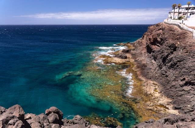
North-West of Gran Canaria: Sardina del Norte, Faro Punta de Sardina and rock pools

Small development next to the lighthouse looks Santorini-esque under hot canarian sun
Small development next to the lighthouse looks Santorini-esque under the hot Canarian sun

By now I walked most of Gran Canaria and liked most of it, too. However, there are still parts of the island of which I am aware mostly because of the photos seen in various social networks. Sometimes I have a feeling people want to keep the most beautiful places to themselves and that is why they don’t explain where they take their photos. If that is the case, they shouldn’t publish the pics in the first place. For me, it works as a challenge, and I imagine I am not the only one.

Beautiful water, isn’t it?