Showing posts with label photography. Show all posts

Sunday, November 15, 2020

Barranco Hondo, the Deep Ravine, and Salinas de Tenefe

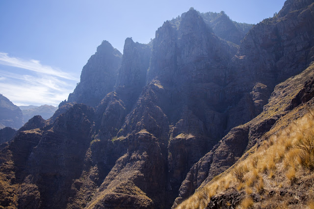
Impressive cliffs

The second walk we’ve done in a very short stretch of time — we are all worried that our long awaited freedom will be suddenly taken from us again — is another one that was new for me. The south of the island is full of deep and steep ravines, and one of them has a double arch, called Arco del Coronadero. Of course, we had to go, because, as the famous saying goes, “it’s there”.

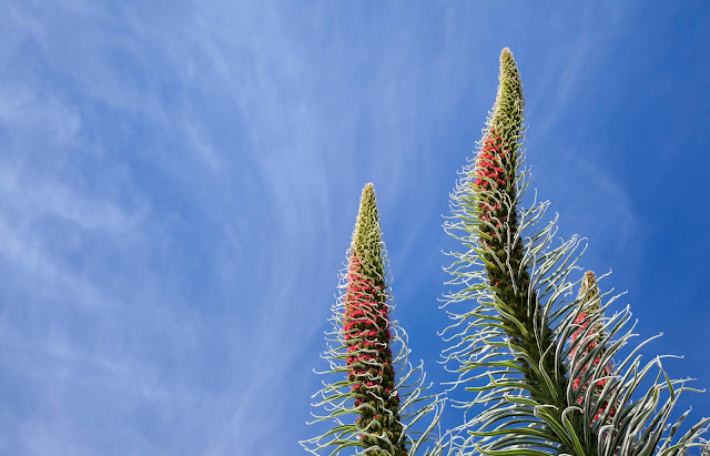
Euphorbias large enough for all the King’s horses and all the King’s men to get lost in

Tuesday, November 10, 2020

Grand Canyon of Gran Canaria — Punta de las Arenas or Playa de Artenara

Smooth sandstone walls, arches, caves and grottoes

While we continue to live in a situation where very few leisure things work*, we have to make do on our own the best we can. Last week we arranged a couple of hikes and I would like to record them. I’ll start with the last one, a hike to Punta Arenas aka Punta de las Arenas, Punta de las Arenas Blancas, a relatively short hike between the old road to La Aldea de San Nicolas and a light colored sandstone cape below it. The various names of the place all refer to Arenas, i.e. sands. I read that what is now sandstone used to be the sand of a beach which due to geological processes has risen above the level of the sea and is now effectively a fossil of a beach. The sandstone is pale yellow, hence the name of Arenas Blancas, i.e. white sands.

The cape, as seen from the beginning of the walk. Most of the path down is done in the shade

Thursday, May 16, 2019

Up we go

Alien tentacles! Cthulhu raising to the surface! Tremble, you feeble humans... etc

When I went up the Mount Teide two years ago I didn’t really have a plan. Well, I had the most basic of all plans — to go up and survive. People told me two things at once — first “it’s kinda easy, you just need to pace yourself” and the second “but the altitude sickness can strike even the most fit people”. With this mixed message in mind, I can tell you I was going up listening to myself and asking all the time “am I ok?”, “am I still ok?”. I was perfectly fine, but this type of self-monitoring is not conductive to enjoyment.

This time I knew it was doable, and my first concern was the weather. What if the (blasted) calima turns up again? We won’t be able to see anything!

I can say straight away that we were much luckier this time — there was almost no dust in the air and the visibility was a lot better. First day, we saw Gran Canaria, La Palma and La Gomera above the sea of clouds while still on the bus. Next day, only La Gomera was visible from the top of the mountain at dawn, but that was also fine — I personally didn’t even get the camera out of the backpack, see the explanation later.

Friday, April 05, 2019

Spring equinox sunrise at the necropolis of Arteara

Somebody switched on an enormous spotlight behind Amurga massif.

On one of our very first visits to Gran Canaria we booked a stay in a village called Fataga. The reasoning was that the holiday house looked really nice and that it was “only” 45 km from the airport. We were thinking in terms of Fuerteventura or possible even East Anglia, where 45 km on the flat is no distance at all. What can I say. We were wrong. Between the airport and Fataga there is an enormous Amurga massif. You can either go through a steep and narrow pass called Degollada de las Yeguas or go a longer and somewhat less steep route through San Bartolome de Tirajana. The second option is easier, but you need to know that beforehand. We didn’t. The most difficult bit is going up to the pass from Fataga to airport (opposite direction being downwards and therefore easier). When I tried to do it the first time, I got stuck on the steepest curve. I kept stalling the motor and try though I did, couldn’t advance even an inch. If anything, I was going backwards with each stalling. A small queue of cars started to form behind me immediately, and eventually a giant tourist bus joined them. A guide from the bus, very nice and polite German guy, run up to us and asked what was going on. When he found out that nothing was wrong with the car itself, he suggested to drive us to the pass, and did. I was enormously grateful to him, still am.

That all happened in daytime (hence the queue and the help). We, however, were supposed to drive to the airport in the small hours, in the darkness, on the empty road. So. I chickened and we changed the booking for the last night to a guesthouse in Ingenio. I did have to drive the same road one more time of course, but not at night and I was mentally prepared to what was coming and managed ok this time.

Why am I telling you all that, all these years later?

Sunday, December 23, 2018

Lensbaby, stars, fishes and hearts


Christmas tree decoration in the Barranco Guiniguada, between Triana and Vegueta
I want to have a break from all things hiking and show some of the experiments with Lensbaby. I took it out of its little bag where it was left undisturbed for a looong time because I thought I should sell off the stuff I never use.

My Lensbaby is a first primitive Composer, fully manual, move-it-as-you-like, no-one-knows-what-s-gonna-come-out type. I must say the focusing is really tricky, especially in the poor light.

Thursday, October 11, 2018

Lomo de San Pedro - Cuevas de Berbique - Puerto de Las Nieves


Impressive cliffs of Tamadaba.
After I went to see Cenobio de Valeron I've shown pics of it to my walking companions. One of them said that it looked similar to Cuevas de Berbique, a toponym which I had never heard before. Of course I had to find out where it was (close to Agaete) and how to get there. To my pleasure I discovered that it is possible to do a linear walk past the caves using the public transport. You have to start from San Pedro (there is more than one San Pedro, so careful, San Pedro of Agaete). Currently, there is a bus from Galdar to "Valle" (which is valley of Agaete). The end of the walk is in Puerto de las Nieves, and there are buses to Las Palmas every hour.

Wednesday, November 01, 2017

Gran Canaria, October 2017: one month after wildfire and a new toy

Caldera de Tejeda planet

After the wildfire of September 2017 I try to go to Las Cumbres, the highest area of the island, as often as I can, to check things out. I am happy to report that some visible changes are happening already, and I expect many more will happen once we start getting some seasonal rains.